GPS
The motivation for this project was to build a very cheap GPS module for my netbook.
I wanted a device that could forward a GPS signal to a netbook where it could be logged and plotted.
This turned out to be a lot easier (and cheaper) than I had expected.
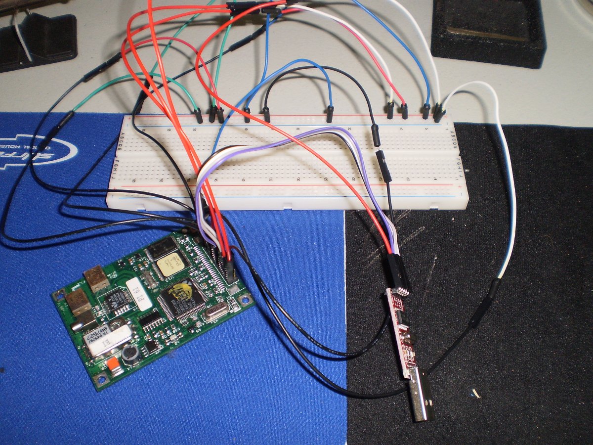
Bill of Materials (both from eBay):
- $12 Rockwell Microtracker TU00-D205-015 GPS Module
- $3.50 PL2303 TTL to USB converter module and Cable
The total cost was under $20 if you include wiring and a small patch board for the connections (not shown in photo) - prices include shipping.
The version of TTL to USB I purchased has 3.3V and 5V out - ideal for the battery backup and chip power, respectively.
I was unable to find a datasheet for the Rockwell Microtracker.
It's important to note that the pinout for this board is different from the
(much more common) Rockwell Jupiter modules.
To determine the correct pinout, I used a helpful reference on the Microtracker - to my
knowledge, it was either reverse engineered or else passed down from the Days of the Specifications.
The reference can be found
here.
Pin 1: Antenna power input. Normally 3-5 volts. Maximum 12v, 100mA.
Pin 2: GPS unit power input. 5.0 volts DC. Draws approximately 175mA.
Pin 4: NMEA/Binary mode select. +5v for NMEA. Ov or floating for binary mode.
Pin 5: Battery backup for RTC only (internal clock). 2.5-5 volts.
Pin 6: Serial Data Out. Output of GPS messages. 0/5v level RS-232 signal.
Pin 7: Time Mark Out. IHz (1PPS) timing output.
Pin 8: CTS/DTR Serial Data control. Ov or floating for normal. 5v stops serial output.
Pin 9: Serial Data In. Commands or data sent into GPS here. 0/5v level RS-232.
Pin 10: Battery backup for Sram and RTC. 2.5-5 volts.
Pin 13: Master Reset. +5v to turn on GPS. Ov or floating to turn off and reset.
Pin 18: Serial Data In from DGPS correction receiver. 0/5v level RS-232
Pin 20: Baud Rate select. Ov for 4800 baud. 5v or floating for 9600 baud.

Pins 3, 11, 14, 17, 19 all Grounded

Pins 12, 15, 16 No Connection
The image below shows the full apparatus in testing form. Simply connected to a computer, using the Arduino IDE's
Serial Monitor on /dev/ttyUSB0 with a baud rate of 4800, it will quickly become apparent whether the device is
working correctly. You should see NMEA output similar to:
$GPGGA,123519,4807.038,N,01131.000,E,1,08,0.9,545.4,M,46.9,M,,*47

![wbrenna [\at/] uwaterloo [\dot/] ca](/wilson/includes/email.png)